Thursday 19 November 2015

Walking on Gran Canaria

Walking on Gran Canaria

Introduction
Most keen walkers from the U.K. or northern Europe get a bit fed up with the cold damp winter, muddy paths, miserable picnics and daylight fading during the afternoon. Well everyone deserves some winter sunshine and a walking holiday on Gran Canaria is the perfect antedote to the northern European winter blues!

Paths through ancient terraces

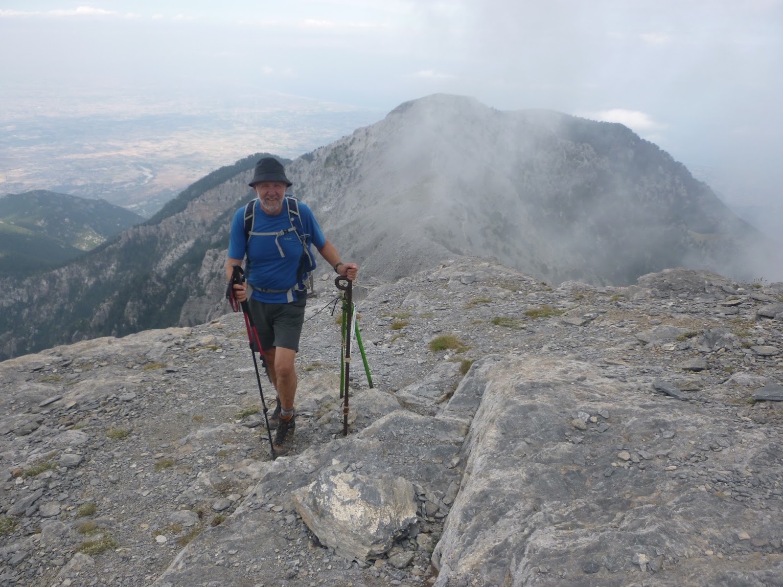
Towards Roque Nublo....
Where it is and Climate
Situated approx 150 Km (90 miles) off the west coast of Africa (Morocco / Western Sahara) and 1350 Km (840 miles) south of Europe; Gran Canaria sits well out into the Atlantic and thus has a cooler more temperate climate than mainland Africa. Throughout the year, the average daytime temperature varies from 20 degrees in winter to 26 degrees in summer.  So it is an ideal venue for year round walking. However November to February are the months with the highest rainfall with between 3 and 5 days of rain per month. Having previously visited both Morocco and southern Spain for walking holidays, I shall be returning back to Gran Canaria for my winter “fix” of sunshine in early March where I expect to walk during warm days with plenty of sunshine! Take a look at my holiday.

What is the walking is like?
Sometimes described as ‘a continent in miniature’, Gran Canaria has a variety of landscapes: forests, hillsides covered in pink almond blossom, rocky paths and slopes, almost lunar (volcanic) landscapes, and lush green valleys.  Although there are coastal walks, the best hiking routes are to be found in the centre of the island, where the scenery is varied and often dramatic.

Well signed paths!

Most of Gran Canaria is hilly and mountainous so don’t expect a week of flat easy walking. That said, even in the mountains, there are some shorter and easier walks described by the local walking expert Rambling Roger. Expect a combination of mountain (rocky) paths, forest paths, old mule tracks and driveable dirt track roads. Rambling Roger has published a series of walks throughout the Island, which can be purchased online.  He also is able to send GPX files of the routes if you want to use a GPS device to aid your navigation.


Where to stay
This is a difficult one with no easy answer. Travelling around Gran Canaria even using a car can be a bit slow.  We have even found roads closed for repair with no advanced warning on more than one occasion!

Tejeda

Puerto de Mogan
The greatest concentration of walks are in the centre of the Island.  However in the cooler months the centre of the Island is the coolest place so you might prefer to stay on the coast and drive for an hour (scenic drive) to get to your walk. There is also plenty of cheap (for mass tourism) accommodation down on the coast at Maspolomas. It is the road from Maspolomas that you would take to get inland towards most walks.


If you are more likely to have shorter walks combined with touring and want to stay somewhere with more character on the coast, then a harbour front cottage in Puerto de Mogan is the place to stay.


If you don’t mind it being a little cooler and want to stay in the mountains then take a look at the pretty village of Tejeda, which is where we will be based this coming winter.  From Tejeda both short and long walks can be had straight from your accommodation.


Useful Resources
Rambling Roger is the definitive source of information about walking on the Island.

Maps. To accompany Rambling Roger’s walks, Discovery Walking Guides have produced a 1:50 000 scale map of Gran Canaria which is available from Stanfords.


Roque Nublo


Mountain House Holidays is owned by Jane Livingstone and Michael Hunt, both qualified International Mountain Leaders.  All of the walks they lead during the holiday have been walked beforehand and researched.


Monday 26 October 2015

How to Climb Mt. Olympus

How to Climb Mt. Olympus

This is a record of our first trip to climb Mt. Olympus, Greece’s iconic mountain. We’ll endevour to include as much detail as possible from our 9 months of research prior to the trip and details of the trip itself.  If at the end of this blog you have any unanswered questions, please feel free to contact us.

The Summit of Skala 2866m in the mist!!


We are Mike and Jane, both qualified International Mountain Leaders working for an Organisation called Mountain Walking Holidays.  We were approached in November 2014 and asked if we could lead a trip to climb Mt. Olympus.  We do not routinely take people on routes that we haven’t already done so we set about researching the mountain and studying the map. This blog is about our first "recee" trip

The map to get
The map we got hold of and used for this trip was Mt Olympus,
1:25 000 published by Anavasi.  We bought it online from Stanfords in London. It’s a plastic rip proof map though by the end of the trip some of the printing was peeling off the base.  However due to the poor visibility we encountered it got a lot of use.

Mt Olympus has three peaks: Skala 2866m, Skolio 2905m and Mitikas  2918m. Both Skala and Skolio are accessable to walkers, Mitikas involves some easy but very exposed rock scrambling.

The usual starting point for a trip to climb Mt. Olympus is the small town of Litochoro.  From here depending oun your route it is normal to drive or take a taxi to one of the high starting points. We found a delightful guesthouse, The Palio Litohoro whose owner used to guide on Mt. Olympus. We stayed in Litochoro for the first and last night of the trip. The guesthouse looked after our travel bags whilst we were on the mountain.  The guesthouse also arranged a taxi to take us up to our starting point; around 30 Euro's each way.


Palio Litachoro Guesthouse, highly reccomended

Eating out in Litochorro is easy, there are plenty of restaurants listed on Trip Advisor. We found Meze Meze on the first night, it was so good that we ate there again on our last night. 

The Enipeas Gorge
Most people start their ascent from the road head at Prionia and ascend to “Hut A” for a night before making their ascent of Skala and possibly Mitikas before returning to Hut A for a second night. The descent to Prionia (where you can phone for a taxi) or a further 5 hour walk back to Litochoro via the spectacular Enipeas Gorge.

We had decided against an “in and out” trip favouring a journey through the mountain.  Our plan was to traverse the mountain and if possible take in all 3 summits.

Starting at a high point of Gortsia 1100m we planned to walk to “Hut C” on the Plateau of The Muses at around 2600m. (There are two huts, Hut B and Hut C fairly close together on the Plateau). We chose Hut C because it is smaller and we thought it might have more character.  In hindsight this was a mistake and we’d probably go for Hut B next time!


The walk up to the Plateau of the Muses had only a few short steep sections and was not difficult.  The final pull onto the Plateau had a short section of chain (10m) though this is avoidable by a short detour which is taken by the mule trains that supply the huts. We started walking just after 9am and were at  “Hut C” for 4.15pm.  This included a half hour stop at a really nice hut owned by the local Mountain Rescue Team at Petrostrouga 2120m where we had some tea at around noon.


Mules keep the huts supplied

If you were arriving into the area for late morning or early afternoon, I would consider walking up to the hut a Petrostruga as an alternative to a hotel or guest house in Litochoro.


Arriving at Skourta 2476m

Above Petrostruga the path continues gently up through more ancient forrest. After about an hour the trees end and a short steep pull brings you to a small summit of Skourta 2476m.  From here you follow an impressive ridge line to the Plateau of The Muses 2600m.


The ridge above Skourta with the Muses Plateau visible

Hut C supposedly sleeps 18 people.  The night we stayed it was unpleasantly over crowded though in all fairness the Guardian provided great food.  The facilities include proper squat toilets. Blankets and pillows are provided but you need to take a sheet sleeping bag.  Slippers are also available so you don’t need to carry extra shoes with you.

"Hut C"


As we arrived at Hut C, the mist rolled in and the stunning views that we had enjoyed all day disappeared.

Our plan for the “summit day” was leaving at around 9am to walk the short distance to Mitikas, leave our rucksacks at the bottom of the ascent gully and scramble up to the summit and back.  Then re-united with our kit, follow paths around to Skala and Skolio before descending to Hut A.


We awoke to find ourselves still shrouded in mist and with persistent rain! The Guardian of Hut C told us that it was too dangerous to climb Mitikas in the wet. (polished limestone is notoriously slippery when wet). So we revised the plan to walk around to Skala and make a decision about Skolio. Leaving the hut at 10am we reached Skala, still in the cloud at noon.  We’d had none of what are described as superb views but a great feeling to reach the middle summit of this iconic mountain.

Lunch stop on the descent from Skala


On leaving Hut C, we used our map and compass navigation skills to check our progress across the Plateau and to make sure we picked up the correct path. Although most days through the summer this is an easy mountain to navigate, make sure you have the skills, just in case.  Otherwise hire a guide!!

Back on Skala we were damp and had no views.  Although Skolio is only an easy 1Km walk away, we took the decision to descend down to Hut A 2060m.


Hut A is big!  It’s well equipped, well run and Maria the Guardian is friendly and efficient. But don’t expect a hot shower!  A log fire was burning hot in the dining room and we had a glorious evening with plenty of great food and wine.


Fine Dining in Hut A

Our trip was at the beginning of September.  Chatting to the local guides on the mountain, they confirmed that our choice of route was good but that we should have come in August.  August is apparently the month to climb Mt. Olympus!

The bar at Prionia
It continued to rain all night and there really was a small river running past the Hut in the morning.  However the rain stopped and though we were still in the mist, we set off at 9.15am towards the road head at Prionia 1100m which we reached at noon.

The road head at Prionia is really a car park with public toilets and a nice bar / restaurant. The weather was still not inviting enough for the full 5 hour hike along the Enipeas Gorge so we decided to walk down to the old monestary at Agios Dionisios. The people at the bar were really helpful, after a round of coffee they contacted our taxi and arranged for us to be picked up.  Fantastic.


Agios Dionisios
The old ruined monestary at Agios Dionisios is a pleasant hours walk down the gorge and well worth a visit.  It is now being actively re-built from a ruined state, blown up by the Nazi’s during world war 2.

So with the Taxi collecting us at 1.30pm, we were back at the bar at the bottom of the Enipeas Gorge for lunch.


We shall be running this trip commercially in August 2016.  It is unlikely that the weather will be as bad as that described above.  Come and join us!

Mt Olympus, the view we didn't see. Photo Don Corleonegeorge taken from Hut A's Facebook page 


Adventures in Swaziland!

"Welcome back Jane" was the greeting when the All Out Africa drivers met our group at Johannesburg airport. This was to be my third trip to the Kingdom of Swaziland, one of Africa's smallest countries, so I knew what the drive would have in store. We drove out of the city on a modern motorway, and were soon heading east over the plains; not the most stunning drive, but our stop at a service area made up for it, as it is also a farm and gave us our first sight of African animals such as water buffalo and ostrich.

Leaving the motorway, the scenery becomes more interesting; Swaziland is surrounded by upland, or highveld as it is known in Africa. The western border with South Africa is particularly interesting, and would be the focus of our wilderness trek the following week. Border formalities done with, and our driver was noticeably happy - "welcome to Swaziland" he beamed - really proud to show off his country!

A short drive and we arrived at our first nights camp, but not before making a short stop for provisions. We were in the Malkerns valley, the heartland of Swazi tourism, so the supermarket was modern and well stocked; familiar brands with a local flavour! This was a camping trip, and our base was run by All Our Africa who have both a tour business and support a range of charitable projects. The campsite was in a lovely setting, with good facilities, and we were soon relaxing watching the sun go down on our first night in Africa.

The next morning we were to have an introductory talk from our hosts, then move on. I asked our driver if we could shop at a nearby market, rather than just buying supermarket food; this proved to be a great experience, negotiating prices for small sacks of fruit and vegetables and admiring the array of handmade tin chicken feeders!

Our drive continued towards the east, where we would be spending a few days at Shewula mountain camp. Shewula is community tourism project amongst the 500m Lubombo mountains, where you can walk, share in the life of the community and its health or childcare projects. We were to work at a primary school, but while there met a number of Dutch visitors who really enjoyed the walking tour and hospitality from the ladies of the community. The appeal to me of Shewula was being able to walk amongst a rural community, watching life go on, have conversations and generally see a bit of the real Africa - no tourist bright lights here, in fact limited electricity, a variable mobile phone signal and no internet, but in the words of a recent visitor "beautiful place with amazing surroundings. Stars clearly seen at night from a lovely little round hut that you would be sleeping in. The staff are more like family, very friendly and loving and the food that they cook is beyond heavenly! Not for 'Hilton hotel only lovers' this is the perfect getaway for someone who doesn't mind being away from all the hustle and bustle of fast paced life."

Onwards, as our time was limited we left Shewula for Hlane Game Reserve. Described as a "Royal Park" little did we know that the Swazi king was also due to visit! We arrived at Hlane just in time for lunch, and a brief look around before joining the sunset game drive - sunset is around 5:30 in winter. The drive takes place in covered jeeps, and I commented to our driver that the old vehicles from my previous visit had been replaced - yes, he replied, just this week! The game drive was great, with probably the highlight being a tall elegant giraffe and its baby, walking into the setting sun. That evening we were treated to a brilliant display of traditional dancing, with optional audience participation! Up early the next morning for a second game drive, during which we got really close to a group of lions, and some elephant, as well as wildebeest, impala and warthogs. As we returned to the camp, it became obvious that something was happening; I asked the staff, and was told that the King was arriving that afternoon. Prior to being open to the public, the 30,000 acre site was a royal hunting ground, and King Muswati still visits each year. Sure enough after a much increased military and police presence, the royal cavalcade arrived - something for us all to write a blog about!

Our final destination was back west to Malolojta Nature Reserve - over 4,000 acres of mountain wilderness, and a conservation area. Here we were to enjoy the African bush in it's raw state, but first a bit of adventure in the form of a jeep drive and 'canopy tour' zigzagging across a ravine on zip wires! I was nominated to go first and take the photos, as we zipped through the stunning scenery! Then rucksacks donned we headed along waymarked trails to the river and our first night of wild camping. After 3 visits to Malolotja, my favourite place is still the potholes - giant pools scoured out of the Rock and fed by a lovely waterfall. Here we relaxed, the intrepid members of the group had a cold swim, and that evening watched baboons climbing the rocks above, then reminisced about the trip which was drawing to a close.

Swaziland is a small country, but a great and varied destination for the visitor. We are hosting our own Swaziland Adventure in 2016, a walking holiday with a range of walks, including the 2 day wild camping and canopy tour in Malolotja; see our Mountain Walking Holidays website for the details.

Monday 28 September 2015

Mt Olympus, Highest Mountain in Greece

Climbing Mt Olympus

Mt. Olympus is the highest mountain in Greece.  It has three summits: Mitikas 2918m;  Skala 2866m;  and Skolio 2905m.  Mitikas involves some easy but exposed rock scrambling, so most walkers ascend Skala 2866m which is nearest to “Hut A” the nearest mountain refuge.  Although Skolio 2905m is only a short walk further than Skala, it is not so often ascended.

At the start!


The ancient Greeks believed that Zeus had his throne on the highest peak, Mytikas which was also home to the other 12 Olympians (Greek Gods).

Climbing Mount Olympus is a non-technical hike, except for the final section to the summit of Mytikas peak, which is a grade 1 or 2 scramble depending on the route taken.


Gaining the "Muses Plateau"


Mountain House Holidays have recently (September 2015) returned from running their first trip to Mt Olympus where everyone ascended Skala. Unfortunately it was a day spent in the mist and drizzle and the Guardian of “Hut C” where we spent the night before our summit attempt advised us that Mitikas should not be attempted in wet conditions as limestone is notoriously slippery in the wet. None the less a very successful trip made all the better by the helpful Greek people who were all keen to ensure that we had the best possible time.


Mules are used to supply the huts on Mt. Olympus


Next year (2016) we are including Mt. Olympus back on our itinerary though we will be going a month earlier when we are assured that the weather is better!

Mountain House Holidays will be organising 5 day midweek trips in August 2016. These trips will be led and supervised by qualified International Mountain Leaders. The programme will be as follows:


Monday
We meet you at Thessaloniki Airport and transport you Litochoro, where we will stay in guesthouse accommodation. If there is time in the early evening we can have a short walk in the Enipeas Gorge.

The mist rolls in!!


Tuesday
An early start taking a taxi to a high road head where we walk high into the mountains, initially through ancient forest. We continue steeply up the mountainside to reach a mountain hut at around 2600m on the spectacular “Plateau of The Muses” where we will spend the night. The refuge has dormitory accommodation, blankets and pillows, but you will need to carry a sheet sleeping bag and sandles or trainers.


The Summit of Skala
Wednesday
An early start will enable us to make a traverse of the mountain. For those who want to make the short scramble, Mytikas 2918m is a possibility. We will then continue for the non scramblers to Skala 2866m and possibly Skolio 2905m before descending to Hut A for a second night on the mountain.

Thursday
We continue our descent off the mountain and reach a high road head in around 3 hours. We then descend through the spectacular Enipeas Gorge to  return to Litochoro and a well earned celebratory meal.


Dinner in Hut A.
Friday
We depart Litochoro and return you to Thessaloniki Airport


Monday 6 April 2015

Winter Sun Hiking in Gran Canaria

Dramatic mountain scenery, warm settled climate, a myriad of ancient trails, Spain, with just a touch of Africa!  These are just a few of the highlights of our trip to Gran Canaria in February 2015.

We were aiming for a week relaxing in the sun, but not really being beach people, the hills and mountains beconned from the very start, and we were soon driving towards the mountainous centre of the island, with increasingly dramatic scenery.

Gran Canaria is part of Spain, so our moderate Spanish was useful, though not quite the same as southern Spain, as we discovered when trying to order our usual 'tostada con tomate' only to find that toast was not usually eaten for breakfast, nor tomato and olive oil readily available!  However we saw lots of tomatoes growing near the coast, together with banana, mango and avocado plantations, some rather weird cacti, stunning bougainvillea and almond blossom.

Back to the walking; many of the trails we walked were old Camino Reales - ancient trails, with a similar status to the English rights of way, which are gradually being restored and waymarked for walkers. Although there are coastal walks, the best routes we found were in the centre of the island, where the scenery is varied and often dramatic. We found ourselves walking through forest, hillsides covered in pink almond blossom, rocky, almost lunar Landscape, and lush green valleys; indeed a 'continent in miniature' as the island is sometimes described. 

Probably our best walk took us to the summit of Pico de Las Nieves - no snow to be seen, indeed sadly not a lot to be seen the day we were there, as the final 100m was shrouded in mist!  However it was a great walk, with a wonderful descent through spectacular terrain.

We did have a couple of days exploring and particularly enjoyed wandering We around the fishing boats of Puerto Morgan, and dramatic drive northwest from the pretty village of All in all a good trip, with lots more walking to be done. We are already planning a return trip to lead a guided walking holiday on Gran Canaria in 2016 - everyone deserves a break from the British winter! So why not join us.

Thursday 19 February 2015

Climbing Mt Olympus

Climbing Mt Olympus

Mt Olympus 2918m is the highest mountain in Greece.  Although Olympus is a name familiar to everyone in the western world, very few know much about this mountain and even fewer have climbed this rocky peak.

Mt Olympus, Home of The Gods!

British based walking holiday company, Mountain Walking Holidays are now pleased to announce that they are including a walking trip to climb Mt Olympus in their programme for 2015.

Snow covers Olympus from November until late May making the exposed upper section tricky to cross. The rocky summit continues to delight everyone who makes the ascent as it did the ancient gods.

We meet at Thessaloniki airport, drive to Litochoro, where we will stay in guesthouse accommodation. The following day we walk high into the mountains, initially through ancient forest. We continue steeply up the mountainside to reach the spectacular Muses plateau, where we will spend the night. The refuge has dormitory accommodation, blankets and pillows, but you will need to carry a sheet sleeping bag and slippers or flip-flops.


Mytikas Summit from Skala
An early start will enable us to make a traverse of the mountain to reach Mytikas, the summit of Olympus at 2901m. This part of the climb can be difficult, involving some scrambling, so you will need a head for heights. If time and conditions allow, we will continue on to scale Skala at 2866m before making our descent down to one of the lower refuges.

The final day we walk through the spectacular Enipeas Gorge to return to Litochoro and a well earned celebratory meal.

The Olympus National park has been recognised as an “area of international importance for the environment of mankind”. It is dedicated to the protection of the natural habitat of plant and animal wildlife. You may spot wild animals such as goats, deer or the wild boar and eagles, or vultures. The slopes are particularly well known for their plants, which attract lots of butterflies.

Ariel view of Mt Olympus in winter
Temperatures in the mountains can be very variable, ranging from hot sun to wind and rain. The proximity to the sea give Mount Olympus a it is a Mediterranean climate, i.e. hot and dry in summer, but the mountain gets lots of rain and wind, so you will need to be prepared. Daytime temperatures are likely to be in the low 20’s centigrade. Sun screen and hats are essential as is windproof and waterproof clothing.


Mountain Walking Holidays are run by Jane Livingstone and Michael Hunt, both qualified as International Mountain Leaders.

Details of this Holiday and how to book are on the Mountain Walking Holidays website.


Sunday 18 January 2015

Why Use a Qualified Guide in The Mountains?


Why Use a Qualified Guide in The Mountains outside the U.K.?

That’s it, I’ve submitted my logbook of CPD training to the “training officer” and been passed as current satisfying the training requirements to continue as an InternationalMountain Leader!  It takes effort to stay qualified…………

IML's Practicing Navigation at Night
The only British qualifications valid for taking people into the mountains outside the U.K. are either the International Mountain Leader (IML) or the Mountain Guide (IFMGA). Those holding these qualifications are members of professional associations who issue their guides carnets to operate on an annual basis.

Assessing People in The Mountains Course, PyB
Overseeing these qualifications in the U.K. are:
i.   BMG         British Mountain Guides;     and
ii.  BAIML    British Association of International Mountain Leaders.

IFMGA Guides can operate on terrain where the use of ropes and technical mountaineering will be necessary.

IML’s operate on terrain where ropes and technical equipment are not routinely required, though are trained in their use (just in case).

IML’s have to be able to demonstrate that their skills are current through CPD training and hold a current wilderness 1st aid certificate along with appropriate liability insurance.

-----------------


My Carnet (front and back)
At the point of renewing my carnet on January 1st this year, I was asked to demonstrate that I had enough current and relevant training. This I duly did and “passed muster.” My carnet has been reissued allowing me to continuepractising as an IML.


Since qualifying as an IML in March 2010 I have undertaken 10 days of (CPD) training including the following:

Teaching Navigation (2 courses);
Altitude Sickness;
The Mountain Environment;
Glaciation;
Assessing People in The Mountains;  and
Teaching Hill and Mountain Skills.

All of this CPD is in addition to the rigorous training and assessment both summer and winter to obtain the qualification in the first place.


Nasty Leg Wound! Wilderness 1st Aid Course
The one thing that I am confident in saying is that you not only get a qualified guide when you hire an IML, but you get someone who is “current” and the added value bought with the volume of CPD opportunities. By hiring an International Mountain Leader to guide you in the mountains not only should you be safe, but the level of environmental interpretation should be 1st Class.


Working overseas for much of the year, mainly in Spain, I am amazed at the increasing number of Brits who set up walking businesses, call themselves guides and proceed to operate illegally (as unlike the U.K., you need to hold a qualification to lead people for money in Spain). Unfortunately it will take a fatality before these people are investigated.


So there you have it!  When booking your walking holidays in the hills or mountains ask if your guide will be qualified (and insured).  A qualified guidecarries a “carnet” and their website and advertising should display the correct logo.

IML Ropework Refresher Course