For the past 2 years, Mike has been supporting a group of people with a learning disability to 'walk with a ranger' each Thursday afternoon. The group not only developed a love of walking, but grew in confidence, and achieved the John Muir Award and helped a number of the Peak Park Rangers to understand more about people with a learning disability. Some members of the group decided they would like to try something a little more taxing, so on Friday 31st October,
the Mountain House Team launched a new Friday Peak District Ramblers group. We try to pick routes that are suitable for people with awkward or limited mobility (avoiding high stiles or ladder stiles). On Friday 31st October we started from Tideswell Dale car park and walked a circuit via Litton Mill and Litton.
Friday, 31 October 2008
Thursday, 9 October 2008
Visit to No. 10!

Mike was very proud to receive an invite to 10 Downing Street (in his capacity as a member of the BMC Executive Committee and Mountain Leader Training), the event was a reception in ‘Celebration of British Mountaineering' and attended by. The BMC team were accompanied by a selection of some of the most respected mountaineers and climbers, including Sir Chris Bonnington, along with Sport England representatitves and Sports Ministers, Gerry Sutcliffe.
Mike is pictured here with Andy Cave and Alan Hinkes.

Tuesday, 28 August 2007
Marsden - Edale
We usually like to make up our own walks, taking in new and interesting terrain mixed with testing navigation. Something that is not usually written up in books and followed by the crowd. The Marsden – Edale though written up is more of a concept than a route. There is no official route! Wessenden Valley Marsden to Edale. “The most famous moorland traverse of all” as described by Byne and Sutton in their excellent book “High Peak” (1966 now out of print).
This 25 mile walk traverses three high plateaus, Black Hill, Bleaklow and Kinder Scout and tackles the harshest terrain the Peak District has to offer. There is no official route to follow and there are many variations that can be taken according to conditions, fitness and navigational skill.
The early popularity of the walk (1920’s and 1930’s) was due to the fact that both Marsden and Edale can be reached by train, which was especially important in the historical context to Peakland walking with its then popularity mainly in the working classes. The walk is originally attributed to Cecil Dawson and Ross Evans at the beginning of the 20th Century. Dawson was a particularly strong walker who inspired a generation with his long distance walking exploits. His large group of friends or followers, “Dawson’s Crowd” became known as the 94th with Dawson as their Colonel. They took to wearing gymshoes to move faster giving a competitive edge to their walks.
In 1925 members of the newly formed Bogtrotters Club completed the double, Marsden, Edale and back again. Alf Bridge, besides being a top climber was also a top bogtrotter and was elected President of the Bogtrotters in 1927, the year he completed the Marsden – Edale in around 4 hours.
With the growth in Peakland walking during the depression years of the 1920’s and 1930’s the Marsden to Edale became the “yardstick” by which every strong walker measured themselves. The course has now become a fixture on the fell running calendar and the current record set in 2000 stands at an unbelievable 2 hours and 45 minutes! To my knowledge there have been 3 deaths, of people undertaking a "challenge walk" caught in a blizzard descending from Bleaklow.
Our recent stroll from Marsden to Edale took 12 hours in pleasant summer conditions on August Bank Holiday Monday ……………..
 The walk leaves Marsden by Binn Road which leads into the Wessenden Valley. The valley is followed along an easy track besides the reservoirs. (It should be noted that some people prefer to walk the moorland above and on the western side of the reservoirs, Great Butterly Hill and White Moss, though this is rougher underfoot). From the 4th reservoir (Wessenden Head Res.), another broad track is reached which leads up to the B road a short distance from the A635. At the road junction with the A 635 we have reached 451m, a height gain of 218m in 5.5Km. So far it has been easy going and quite painless.
 West along the A635 for 200m brings us to a footpath signposted Black Hill. Unbelievably the path is paved nearly all the way to Black Hill. No navigation skills required yet!
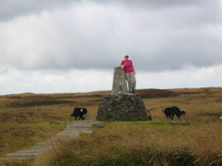 The Summit of Black Hill
At Black Hill a decision has to be made, whether to head south on less well defined ground to Tooleyshaw Moor, White Low and Hey Edge to descend to the A628 by the chapel near Woodhead Dam; or to follow the Pennine Way to Crowden, a little further but on defined paths so the map and compass can stay in the rucksack. It had been a wet summer so we chose the latter. Prior to Black Hill we had seen only 2 other walkers, both on the section between the A635 and Black Hill. After joining the Pennine Way, we must have passed over 50 walkers heading north from Crowden to Black Hill. I’m sure that if we had taken the more direct route we would not have met anyone until near Crowden. We ended up having several lengthy conversations with people attempting the Pennine Way, all very sociable but a hindrance with time limited and so far still to go.
From near the old YHA at Crowden we turned east along the A628. In a few yards there is a concessionary path that leads down into the valley and across the river just beneath Woodhead Dam. The path leads up to the B6105 and a gate opposite up onto The Longdendale Trail. It used to be possible to cross onto the moor near here and traverse diagonally up towards Wildboar Clough, however there is now a shooting club between the trail and the moorland of Bleaklow. We had been able to hear the shooting all the way from Black Hill and the various huts and bunkers built by the shooting club could be seen littering the North side of Bleaklow from before we passed over Laddow Rocks.
 Bleaklow seen from near Laddow Rocks
Our detour west along the Longdendale trail looking for an access point was turning to despair when we came across a signpost to Wildboar Clough. Excellent. The path upwards is not well defined and eventually leads into the interesting section of Wildboar Clough. Those who want to scramble can stick to the clough (also a good ice climb in the right conditions) though with our dogs we chose to stick to the fence bounding the western side of the Clough. The clough levels out and is followed through open moorland to the summit of Bleaklow Head at 623m? In good conditions, crossing Bleaklow this way presents no real problem. It is however a different proposition when the mist is down or when there is snow on the ground.
 Woodhead Reservoir from Wildboar Clough
Leaving the summit we followed the Pennine Way southwards to Hern Clough. Once again we started to meet people. Where the Pennine Way changes from a southerly direction towards the south west heading for Snake Summit, we cut across open moorland towards the shooting cabin in Upper North Grain (near the rain gauge marked on the map).
 The Cairn of Bleaklow Head
Some Marsden – Edale travellers may wish to continue to Snake Summit and either follow the Pennine Way to Edale (longer) or cross Featherbed Top, Ashop Clough, Fairbrook Naze and across the centre of Kinder to the top of Grindsbrook Clough (as described in the excellent book, The Big Walks by Ken Wilson and Richard Gilbert 1980).
 A good picnic spot in Upper North Grain
Our path on was through Lady Clough Forrest on a path running parallel to the (A57) Snake Pass. Neither of us had walked this section before and although tame compared to the open moorland, gave pleasant relief to aching feet as we trogged over deep pine needles.
Could we pass the Snake Inn without stopping? No we couldn’t. Another path from near the Inn leads to the access point at the bottom of Fair Brook. We crossed Fair Brook and took the diagonal ascending path into Gate Side Clough. A final steep pull up beside the ruined wall saw us onto the Kinder Plateau. We really were on the home stretch now. The compass proved right as always and bought us safely across the 1.5Km of Kinder Scout to the top of Grindsbrook Clough.
 In Gate Side Clough
Time was getting on and we were tired. Jane had thought to bring a torch, I had not. We were now moving as quickly as possible to avoid getting down after dark. We watched the moon rise and were thankful that it was full. The last section to Edale is on stone flags which although are a good job for preventing erosion, were murder on our aching feet. We entered Edale in twilight, 12 hours after we had set out.
 Looking down Gate Side Clough across the A57 to Oyster Clough
Could we have completed the walk quicker? Maybe. We had stopped for several conversations with fellow travellers: an old boy who had done the Marsden - Edale a few times in his younger days but was now thankful to be able to ascend Black Hill from the nearest road; a lone woman walking back up to Scotland along the Pennine Way after being refused a flight out of Liverpool for Ireland where she was planning to walk because she was told she could not take her stove on the plane. This despite the fact she had flown down from Inverness to Liverpool; We had a leisurely lunch and look around the new hostel at Crowden. What a pity that the café at the old hostel has not moved to the new one; A lengthy picnic tea was had in Upper North Grain and we failed the temptation test at The Snake Inn.
The walk proved to be as challenging as its reputation demanding good navigation, hill skills and stamina. Sheer Class.
 A “Mountain House” navigation course on Kinder Scout March 2006
Tips for a successful completion of the Marsden to Edale:
1. Plan your route well. Do not take it for granted that distances, times or compass bearings written in guidebooks are correct.
2. Create your own route card. Work out your waypoints and compass bearings in advance so you don’t have to hang around in high winds, rain or snow.
3. If you are not used to moorland walking or moorland navigation, get some practice routes in.
4. Carry the right clothing, food, drink and equipment for your intended route and for the time of year.
5. You must have confidence that you can cross rough open moorland in poor visibility or in the dark. Remember people have died attempting the Marsden – Edale.
This 25 mile walk traverses three high plateaus, Black Hill, Bleaklow and Kinder Scout and tackles the harshest terrain the Peak District has to offer. There is no official route to follow and there are many variations that can be taken according to conditions, fitness and navigational skill.
The early popularity of the walk (1920’s and 1930’s) was due to the fact that both Marsden and Edale can be reached by train, which was especially important in the historical context to Peakland walking with its then popularity mainly in the working classes. The walk is originally attributed to Cecil Dawson and Ross Evans at the beginning of the 20th Century. Dawson was a particularly strong walker who inspired a generation with his long distance walking exploits. His large group of friends or followers, “Dawson’s Crowd” became known as the 94th with Dawson as their Colonel. They took to wearing gymshoes to move faster giving a competitive edge to their walks.
In 1925 members of the newly formed Bogtrotters Club completed the double, Marsden, Edale and back again. Alf Bridge, besides being a top climber was also a top bogtrotter and was elected President of the Bogtrotters in 1927, the year he completed the Marsden – Edale in around 4 hours.
With the growth in Peakland walking during the depression years of the 1920’s and 1930’s the Marsden to Edale became the “yardstick” by which every strong walker measured themselves. The course has now become a fixture on the fell running calendar and the current record set in 2000 stands at an unbelievable 2 hours and 45 minutes! To my knowledge there have been 3 deaths, of people undertaking a "challenge walk" caught in a blizzard descending from Bleaklow.
Our recent stroll from Marsden to Edale took 12 hours in pleasant summer conditions on August Bank Holiday Monday ……………..
 The walk leaves Marsden by Binn Road which leads into the Wessenden Valley. The valley is followed along an easy track besides the reservoirs. (It should be noted that some people prefer to walk the moorland above and on the western side of the reservoirs, Great Butterly Hill and White Moss, though this is rougher underfoot). From the 4th reservoir (Wessenden Head Res.), another broad track is reached which leads up to the B road a short distance from the A635. At the road junction with the A 635 we have reached 451m, a height gain of 218m in 5.5Km. So far it has been easy going and quite painless.
  West along the A635 for 200m brings us to a footpath signposted Black Hill. Unbelievably the path is paved nearly all the way to Black Hill. No navigation skills required yet!
  The Summit of Black Hill
At Black Hill a decision has to be made, whether to head south on less well defined ground to Tooleyshaw Moor, White Low and Hey Edge to descend to the A628 by the chapel near Woodhead Dam; or to follow the Pennine Way to Crowden, a little further but on defined paths so the map and compass can stay in the rucksack. It had been a wet summer so we chose the latter. Prior to Black Hill we had seen only 2 other walkers, both on the section between the A635 and Black Hill. After joining the Pennine Way, we must have passed over 50 walkers heading north from Crowden to Black Hill. I’m sure that if we had taken the more direct route we would not have met anyone until near Crowden. We ended up having several lengthy conversations with people attempting the Pennine Way, all very sociable but a hindrance with time limited and so far still to go.
From near the old YHA at Crowden we turned east along the A628. In a few yards there is a concessionary path that leads down into the valley and across the river just beneath Woodhead Dam. The path leads up to the B6105 and a gate opposite up onto The Longdendale Trail. It used to be possible to cross onto the moor near here and traverse diagonally up towards Wildboar Clough, however there is now a shooting club between the trail and the moorland of Bleaklow. We had been able to hear the shooting all the way from Black Hill and the various huts and bunkers built by the shooting club could be seen littering the North side of Bleaklow from before we passed over Laddow Rocks.
 Bleaklow seen from near Laddow Rocks
Our detour west along the Longdendale trail looking for an access point was turning to despair when we came across a signpost to Wildboar Clough. Excellent. The path upwards is not well defined and eventually leads into the interesting section of Wildboar Clough. Those who want to scramble can stick to the clough (also a good ice climb in the right conditions) though with our dogs we chose to stick to the fence bounding the western side of the Clough. The clough levels out and is followed through open moorland to the summit of Bleaklow Head at 623m? In good conditions, crossing Bleaklow this way presents no real problem. It is however a different proposition when the mist is down or when there is snow on the ground.
 Woodhead Reservoir from Wildboar Clough
Leaving the summit we followed the Pennine Way southwards to Hern Clough. Once again we started to meet people. Where the Pennine Way changes from a southerly direction towards the south west heading for Snake Summit, we cut across open moorland towards the shooting cabin in Upper North Grain (near the rain gauge marked on the map).
 The Cairn of Bleaklow Head
 Some Marsden – Edale travellers may wish to continue to Snake Summit and either follow the Pennine Way to Edale (longer) or cross Featherbed Top, Ashop Clough, Fairbrook Naze and across the centre of Kinder to the top of Grindsbrook Clough (as described in the excellent book, The Big Walks by Ken Wilson and Richard Gilbert 1980).
 A good picnic spot in Upper North Grain
Our path on was through Lady Clough Forrest on a path running parallel to the (A57) Snake Pass. Neither of us had walked this section before and although tame compared to the open moorland, gave pleasant relief to aching feet as we trogged over deep pine needles.
Could we pass the Snake Inn without stopping? No we couldn’t. Another path from near the Inn leads to the access point at the bottom of Fair Brook. We crossed Fair Brook and took the diagonal ascending path into Gate Side Clough. A final steep pull up beside the ruined wall saw us onto the Kinder Plateau. We really were on the home stretch now. The compass proved right as always and bought us safely across the 1.5Km of Kinder Scout to the top of Grindsbrook Clough.
 In Gate Side Clough
 Time was getting on and we were tired. Jane had thought to bring a torch, I had not. We were now moving as quickly as possible to avoid getting down after dark. We watched the moon rise and were thankful that it was full. The last section to Edale is on stone flags which although are a good job for preventing erosion, were murder on our aching feet. We entered Edale in twilight, 12 hours after we had set out.
 Looking down Gate Side Clough across the A57 to Oyster Clough
 Could we have completed the walk quicker? Maybe. We had stopped for several conversations with fellow travellers: an old boy who had done the Marsden - Edale a few times in his younger days but was now thankful to be able to ascend Black Hill from the nearest road; a lone woman walking back up to Scotland along the Pennine Way after being refused a flight out of Liverpool for Ireland where she was planning to walk because she was told she could not take her stove on the plane. This despite the fact she had flown down from Inverness to Liverpool; We had a leisurely lunch and look around the new hostel at Crowden. What a pity that the café at the old hostel has not moved to the new one; A lengthy picnic tea was had in Upper North Grain and we failed the temptation test at The Snake Inn.
The walk proved to be as challenging as its reputation demanding good navigation, hill skills and stamina. Sheer Class.
 A “Mountain House” navigation course on Kinder Scout March 2006
 Tips for a successful completion of the Marsden to Edale:
1. Plan your route well. Do not take it for granted that distances, times or compass bearings written in guidebooks are correct.
2. Create your own route card. Work out your waypoints and compass bearings in advance so you don’t have to hang around in high winds, rain or snow.
3. If you are not used to moorland walking or moorland navigation, get some practice routes in.
4. Carry the right clothing, food, drink and equipment for your intended route and for the time of year.
5. You must have confidence that you can cross rough open moorland in poor visibility or in the dark. Remember people have died attempting the Marsden – Edale.
Friday, 29 June 2007
Day 6 Carihuela - Caballo and home!

We were up at first light; I had not had the best nights sleep - the Cabra de Montes which were particularly friendly had been walking over the stone roof of the refuge, keeping me awake. Fortunately the cloud had cleared, and we were soon packed and ready to leave.
Our route took us past the upper reaches of the ski resort, to the Lagunilles de la Virgen, to fill water bottles and then followed a well made path through the Tajos de la Virgen towards the head of the Rio Lanjaron. We had really enjoyed walking this path the previous year, it has been constructed through the boulders and steep slopes below the ridge, and can be followed almost all the way to Lanjaron.

After just over an hour, we reached the col below the Elorrieta refuge. We had decided to stay on high ground, and follow the ridge path towards the summit of Caballo. Our first challenge was to reach the summit of Tosal del Cartujo (3,152 m). This looked relatively straight forward, and we had already walked the route in reverse, however the path was not obvious, and our way involved quite a bit of scrambling (and scrabbling on my part!) to gain the high ground. We were rewarded with great views back toward Veleta and enjoyed a short break before once again becoming concerned at the encroaching dark cloud. The ridge path proved to be much more challenging than the Verea cortá, which winds its way very enjoyably beneath the summit ridge. However our task was to stay up high, and we managed to negotiate the rough ground, loss of path and inevitable boulders to reach the col beneath Caballo (3,005, 7, 9 or 11 metres depending on which map you look at!) just after mid-day. Here we debated where to go next. Our plan had been to leave our packs, climb to the summit of Caballo, then drop down to the refuge for a leisurely afternoon. However the cloud was looking more and more menacing, and neither of us could see the attraction of sitting at the hut engulfed in cold and mist, so we decided to press on.

We reached the summit to enjoy the last of the sun, then made a hasty retreat to a more sheltered spot for lunch. Home seemed so near, yet so far. Our finca is at 1,300m on the slopes of Caballo - 1700m of descent! Following the familiar ridge path was easy enough; we have done it lots of times before and enjoyed the wild flowers and changes of vegetation. The route we have perfected takes us down a fire-break rather than the long and tedious mountain road, but is particularly hard on the knees. After the first half hour, I was really finding the pounding difficult, even with the use of poles. However we did marvel at the way the vegetation was beginning to regenerate after the fire 2 years earlier, the hillside had turned yellow, with an amazing variety of plants, and the fire-break itself was becoming overgrown with pine saplings - all very good news. We made it to our house by the early evening - very tired, relieved to have got back safely and already re-living the experiences. A very welcome cold beer was waiting in the fridge and showers made us feel at least half human again.
Thursday, 28 June 2007
Day 5 Siete Lagunas - Carihuela
 We lingered at Siete Lagunas, taking photo's and enjoying the atmosphere, both wondering if we should spend another night there and make an attempt on Alcazaba. In the end we decided to press on, and began our ascent out of the valley towards the summit of Mulhacén. We had climbed Spain's highest mountain a number of times; although not a technical peak, it does demand some effort and the weather can change very quickly. Out last visit had been the previous September when the upper slopes had a thin covering of snow and ice. This time there was still the odd snow patch, and the cloud, which was blowing in earlier each day, was looking ominous even as we began, helped us to stay relatively cool. The route from Siete Lagunas is probably the nicest of the three options, with an obvious path most of the way, and great views of the 7 lakes below. As we reached the top, the sun emerged, although the valley to the north was filled with cloud. As we scaled the summit boulder to the trig point, we noticed a new plaque had been added to the shrine in memory of 3 walkers from Northern England who had died on the mountain in March 2006.
Leaving the summit the path down to Caldera takes the steep path to the right. Once again, I appreciated having poles, but despite this found my knees aching by the time we reached the road. Until fairly recently, it was possible to drive from Granada to Capileira, using this amazing high mountain road. It is now frequently strewn with boulders, and must have been quite a frightening trip. Caldera is a wide bowl, gouged out by ice, containing a small lake and mountain refuge. We stopped at the refuge for lunch, where we met 3 British walkers who had been planning a trip similar to our own, but been thwarted by the Alberque at La Ragua being closed, and that day had walked over from the ski resort. We shared mountaineering experiences over our bread and sausage, before continuing along the road.

A short way on, rounding a bend we noticed a building on our left, and decided to investigate. It turned out to be another small refuge, which we had not seen the previous year, though it clearly had been there and was marked on the map! The Sierra Nevada had once had numerous small rounded unwardened huts, providing shelter for walkers and climbers, however many of these have fallen into disrepair. This one (described as a refugio forestal on the map) was more in the style of a Alpujarran cortijo, with a flat roof.
For the rest of the afternoon, we followed the road, with the cloud billowing around us, and arrived at the Carihuela refuge around 3.30. Our intention had been to have a snack, then head for the summit of Veleta, which at 3,396 is the second highest mountain in the range. Veleta, sometimes been described as the highest cycle track in Europe has a road leading almost to the summit, and was often considered to be higher than Mulhacén (3,482), as this is how it appears from Granada. Today, the cloud and cold meant we would have had no view, and the thought of a toil up a road, was not at all appealing, so we filled our water bottles from melting snow, made another drink and sat in the hut reading until the 3 British doctors we had met earlier appeared to relive their tales of climbing Mulhacén.
Wednesday, 27 June 2007
Day 4 Vacares - Siete Lagunas

 We woke early, the snow had frozen hard overnight, making melting it for morning drinks quite a chore. While waiting for the water to boil, we watched the sun gradually rising over the peaks, quite spectacular. From our campsite, a small path led through a boulder field then climbed steeply onto the ridge, stepping into the warming sunshine as we reached the col. From here numerous paths climb the slope towards the summit of the Puntal de Vacares. (3,066 m). We more or less followed the edge of the ridge, the path, though narrow and loose at times, was as we made for the rocky summit. We stopped to rest and get our bearings on a broad rock ledge just below the top, and leaving the sacs, made our summit bid! The route westward from the summit of the Vacares is probably the most complicated of the trip, and is often obscured by snow patches (as in our case). We descended through the boulder field for a short way, then made for a Pinnacle 50m east of the summit of the Puntal de El Goterón, which seemed an obvious landmark. This was eventually reached, and led us to another rock ledge and then back onto the ridge for a pleasant descent to the col below Alcazaba. Here we had our usual mid morning snack, gazing longingly at the rocky route on the steep north side of Alcazaba. There were still significant snow patches covering the path, and neither of us wanted to take any chances with big packs and no ice-axes, so we decided on the southern route, of the beautiful valley of the Rio Goterón.
Wandering down the Tajos del Goterón, with it's laguna, we picked our way round the majestic waterfall to the stream, past patches of gentian and other early flowers, to the stream, which was to be our lunch spot. After an enjoyable break, we headed off towards the Loma de la Alcazaba and Siete Lagunas. The path out of the valley, though steep, again proved much easier than we had remembered, and we followed it towards the junction with the Alcazaba ascent route. As we did so, the afternoon mist was once again drawing in and we soon found our view both below and onward completely obscured. We found ourselves following horse tracks, hoping they were going in the right direction, until crossing a rocky section, they disappeared. We got map and compass out and took a bearing. Using the directions for adjusting magnetic variation on the Spanish map (using 1950's map datum) seemed straight forward until we found the bearing taking us downhill; we were convinced we should still be ascending! Jane got out her GPS - she had so far been using it occasionally to mark significant way-points, but had expected to need it for anything else. Having established we knew where we were, the compass was still way off (around 30 degrees), we asked the GPS to take us towards Siete Lagunas, and it very obligingly did so! Of course there were a few deviations on the way, but we managed to pick up the horse trail again and crossed the wonderful borreguiles above Prado Llano before eventually rounding the Loma de Culo Perro and Siete Lagunas, our camp for the night.

A jusifiably popular camp site, the ground around Siete Lagunas was carpeted with gentian and Esterella de las Nieves (star of the snow). We spent a relaxing hour before supper, taking photo's and enjoying the beauty of the surroundings. Still amazed that our fellow campers were the first people we had encountered for over 48 hours.
Tuesday, 26 June 2007
Day 3 Rio Trevelez - Vacares
 By morning, the horses had moved away, and we were able to enjoy our breakfast undisturbed. I was conscious that we had now completed what I had originally (though in hindsight wrongly) thought would be the easier part of the walk, and the next section potentially had some of the more technical stretches of the ridge. On previous occasions, we had found the walk up to Los Ladrones (2,900m) quite hard work. Puerto de Trevelez is a crossing point for old mountain trails and often visited by walkers, however again we saw no-one, and found the early morning walk (taking less than an hour) surprisingly pleasant - are we getting fitter?
 After a photo break we headed on towards Puntal de Juntillas, our first 3000m peak. From here there are really good views of Mulhacen and much of the ridge we would walk that day. Beneath us and to the north, 2 walkers were decending from Picon de Jerez, the only people we saw all day. We wondered where they had started to have arrived there so early?
From here we decended a short way before tackling the horseshoe of Puntal de los Cuartos and Pico de la Justicia. Although it required a little more concentration, overall the route was not difficult. From the summit of Juntillas, we picked a way onto Cerro Pelao (3,181 m). From here we had great views down into the bowl of the Laguna de Juntillas, where we had camped the previous year. This was followed by the rocky environment of the Tajos Negros to reach the high point of Puntal de Los Cuartos (3,158m). Unfortunately the route absorbed my concentration, and I found I hadn't taken any photo's. Other intrepid 'integrallers' have however helped me out.

We descended to the collado de las Buiteras for lunch, by which time for the first time on the trip, the cloud was beginning to pile in. We wondered whether this was going to herald a storm, and debated sitting it out on the col (not the wisest place to be in stormy weather, but better then a summit), however in the end, decided to press on. The path to Pico del Cuervo (3,144 m) takes you through quite a complicated boulder field, and proved difficult to follow from the col. However it has a large cairn at the summit and once again great views, despite the cool cloudy weather. On our previous trip, we had found the descent towards Vacares quite difficult, so decided to stay on the northern side of the ridge. This proved to be a little easier, but not without it's route finding difficulties, again involving some steep rocky steps and a boulder field. However by 4pm we had made it down to our campsite underneath the northern slopes of the Collado de Vacares. There was no running water here, but still big snow patches, so snow melting was the order of the day. We filled our pan and kettle with snow and set to to make drinks and enough water for the evening meal. We shared the camp with 6 sheep and amazingly a young lamb; some had bells, and I had visions of another disturbed night, however they proved entertaining companions and eventually left us, presumably for a less exposed setting.
This was our highest campsite yet, and just beneath the snow, it soon turned cold. As we watched the sun going down behind the hills, we tried to pick out landmarks in the Rio Genil far below. We turned in before dark, a shame in many ways, and one of the drawbacks of having a tent, it just felt too cold to be out, but would have been a great night for watching the stars - maybe next time we should just bivi?
Subscribe to:
Posts (Atom)